- Recent Updates
- Colpoy's Bay
- Colpoy's Bay Introduction
- Spragge's Hill
- The Kalbfleisch House
- The Kalbfleisch Dock
- The Kalbfleisch Marina
- Whicher's Sawmill
- The Wrecks Near Whicher's Mill
- Frame's Falls and John Wood's Grist Mill
- Albemarle Street
- Hughenden and Whicher's Store
- The Community Hall
- The Forest Home Hotel
- The Colpoy's Bay Schoolhouse
- The Colpoy's Bay Church
- Edgehill Cemetery
- Colpoy's Bay From the Air
- A Glimpse of the Past
- Wiarton
- Berford Street
- Berford St. Part 2
- Berford St. Part 3
- Wiarton Harbour
- Bluewater Beach
- Caframo Ltd. and Wiarton Cement Works
- Wiarton Beet Sugar Factory
- Wiarton's Hotels
- Wiarton's Schools
- Wiarton's Banks
- Grand Trunk Railway Station
- The Wiarton Fish House
- The Wiarton Fish Hatchery
- Wiarton's Berford Theatre
- The Wiarton Woolen Mills
- Wiarton's Furniture Industry
- Wiarton's Hospital
- Wiarton's War Memorial
- Wiarton's Town Hall
- Wiarton's Newspapers
- Wiarton's Grist & Flour Mills
- Wiarton's Sawmill Industry
- Wiarton's Gateway
- Connecting Passages
(Links) - Present-day Map
of Colpoy's Bay - Colpoy's Bay
Lot Map (1870) 
Wiarton Timeline- Present-day Map
of Wiarton - Bibliography
- About the Author
- Site Map
(use if menu doesn't work) - Tell me your impressions!
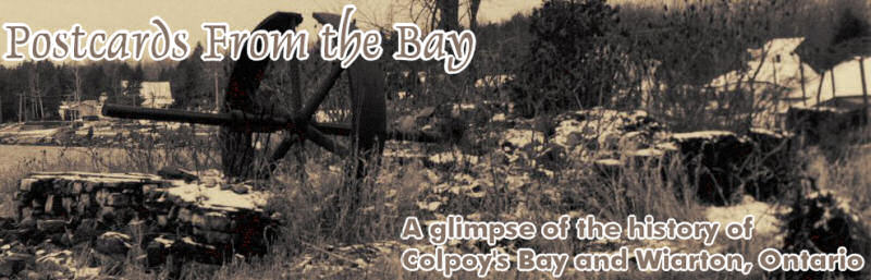
The Kalbfleisch Dock
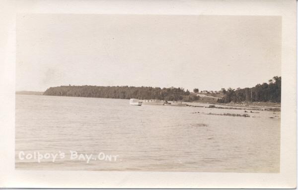
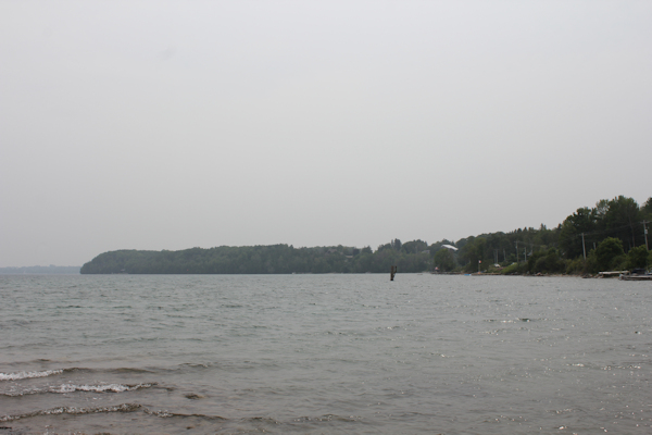
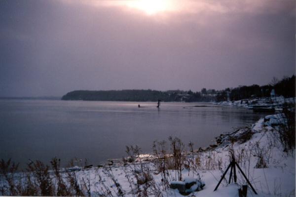
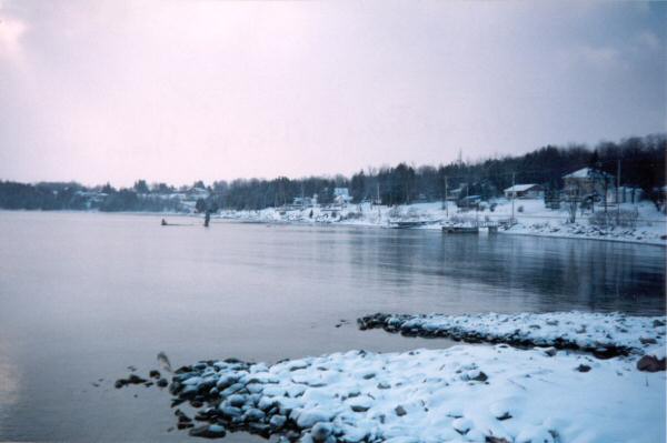
Figure 3A: The Colpoy's Bay village shoreline, looking west towards the Kalbfleisch dock. (Top taken in the Mid to Late 1930's; Second image taken in 2023. Bottom two images taken in 1998).
The images of Figure 3A show the view of the Kalbfleisch dock, as seen from the former land of Whicher's Mill. Contrast the top image of Figure 3A with the second photograph just below. The first, from the early 1930's, displays the original Kalbfleisch dock along with three boats. The dock, as well as the boats, were constructed by the skillful hand of my great-grandfather Edwin Kalbfleisch. The original Kalbfleisch dock was shortened over time by winter ice flows on the bay, but it remained in general use until the mid-late 1980's when it was replaced by a much shorter dock.
Large stones taken from the area served as the foundation of the Kalbfleisch dock. Today, those that underlied to long end of the original dock remain submerged under the cool water of the Bay. They do become visible from time to time when the water level drops sufficiently low. The first image in Figure 3A shows an example of this, where the stones appear as a black line on just above the water line.
Also notable in Figure 3A is Spragge's Hill (visible where the road disappears toward the horizon). The Kalbfleisch house is clearly visible in the bottom photo toward the right.