- Recent Updates
- Colpoy's Bay
- Colpoy's Bay Introduction
- Spragge's Hill
- The Kalbfleisch House
- The Kalbfleisch Dock
- The Kalbfleisch Marina
- Whicher's Sawmill
- The Wrecks Near Whicher's Mill
- Frame's Falls and John Wood's Grist Mill
- Albemarle Street
- Hughenden and Whicher's Store
- The Community Hall
- The Forest Home Hotel
- The Colpoy's Bay Schoolhouse
- The Colpoy's Bay Church
- Edgehill Cemetery
- Colpoy's Bay From the Air
- A Glimpse of the Past
- Wiarton
- Berford Street
- Berford St. Part 2
- Berford St. Part 3
- Wiarton Harbour
- Bluewater Beach
- Caframo Ltd. and Wiarton Cement Works
- Wiarton Beet Sugar Factory
- Wiarton's Hotels
- Wiarton's Schools
- Wiarton's Banks
- Grand Trunk Railway Station
- The Wiarton Fish House
- The Wiarton Fish Hatchery
- Wiarton's Berford Theatre
- The Wiarton Woolen Mills
- Wiarton's Furniture Industry
- Wiarton's Hospital
- Wiarton's War Memorial
- Wiarton's Town Hall
- Wiarton's Newspapers
- Wiarton's Grist & Flour Mills
- Wiarton's Sawmill Industry
- Wiarton's Gateway
- Connecting Passages
(Links) - Present-day Map
of Colpoy's Bay - Colpoy's Bay
Lot Map (1870) 
Wiarton Timeline- Present-day Map
of Wiarton - Bibliography
- About the Author
- Site Map
(use if menu doesn't work) - Tell me your impressions!
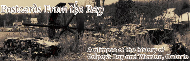
Frame's Falls and John Wood's Grist Mill
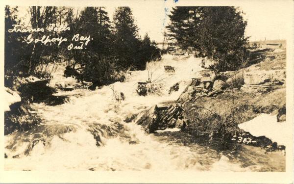
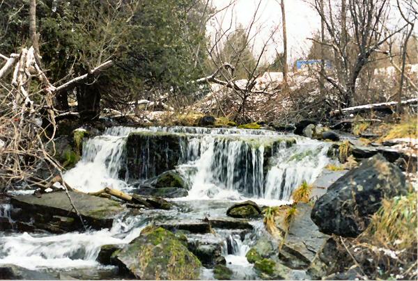
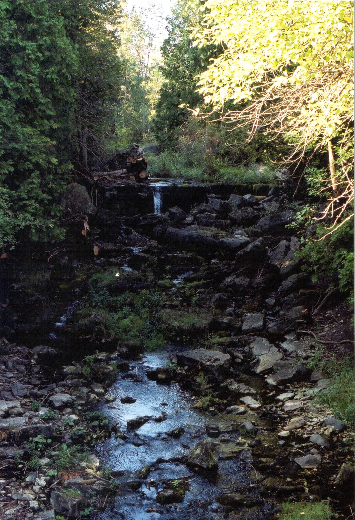
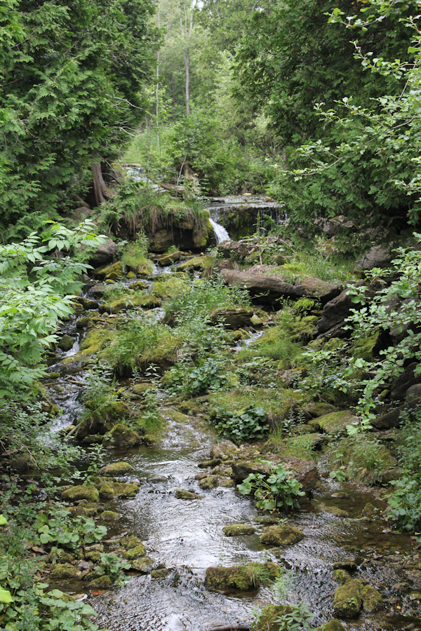
Figure 7A: Frame's Falls, looking upstream at Colpoy's Creek. (Top to bottom: ~1905, 1997, 2001, 2023
Figure 7A shows various views of Frame's Falls on Colpoy's Creek (once called Gleason's Creek). This creek was the source of power for at least three grist mills throughout the history of the village. The first began operation in 1861 under the ownership of Ludwig Kribs, the village's first minister. It was located just below the falls. (As mentioned on an earlier page "Whicher's Sawmill", Kribs also owned a mill on the site that would later host Whicher's mill.) Kribs sold his mill to John Wood (my great-great-great grandfather) in 1870. He operated it successfully for almost 20 years, until he was too old to maintain it. Soon after, it burned (1890). The second, smaller mill on the Creek (further south, closer to the bay - see "Colpoy's Bay Lot Map" in the menu at left) was owned and operated by Leonard Gleason from about 1858 until his death in 1870. The mill was torn down about 1879 and replaced with an improved mill operated by William Bell (who originally owned Whicher's store - featured on another page of this website). This mill burned after a very short period of service.
By the time the second image in Figure 7A was taken, Frame's Falls had, in fact, become quite overgrown with tree growth. (Consequently, I had to do some climbing through the foliage to take that picture!) A photograph like the top one of Figure 7A had become impossible to photograph. However, sometime in the first half of 2001, many of the spruce trees that crowded the view were scaled back and have been maintained since. Now the falls are clearly visible from Kribs Road, as is apparent in the third image of Figure 7A (and note the low summer water flow!). The view was virtually unchanged in 2023.
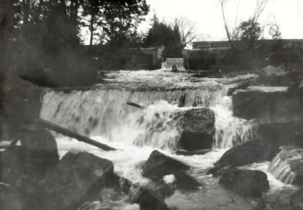
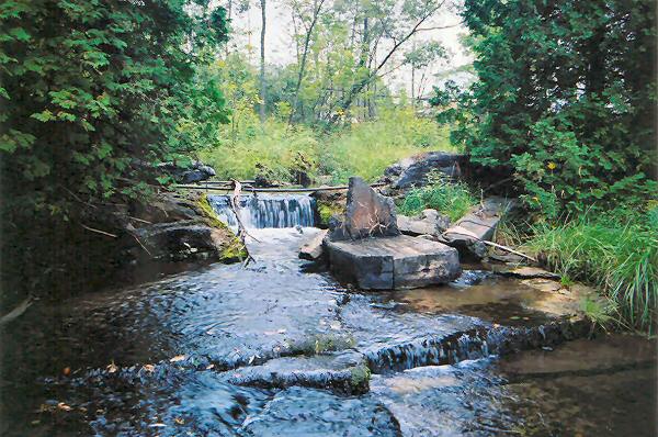
Figure 7B: Dam upstream from Frame's Falls, once used to divert water to light Whicher's Store (c. 1942, c. 2004).
In 1917 C.E. Whicher erected a dam above Frame's Falls (see Figure 7B, above) and diverted water through a pipeline downstream to a generator near his store. This was the only electricity in Colpoy's Bay village until public hydro was installed in 1936. Although badly deteriorated and long unused, portions of Whicher's dam remain today (see bottom image in Figure 7B). In addition, portions of the water flume, encased in cement, and generating station still sit along the eastern bank of Colpoy's Creek (click here to see the flume and generator). As a side note, when I was exploring the water flume in 1998, I noticed some writing etched into a broken section of the concrete. I returned to explore this inscription further in 2001 and as far as I can discern it reads "Caudle Water Apr. 21 1932". The Caudle family worked closely over the years with the Whicher family and was most likely responsible for the upkeep of the water flume. A little personal touch to my historical findings! The flume remains in pretty much the same shape today.
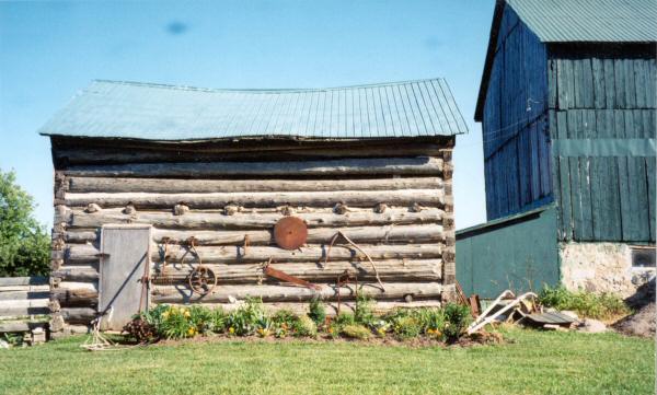
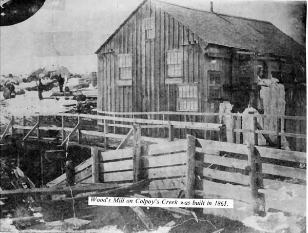
Figure 7C: Wood's Mill in the 1880's. (Source: Day's of the Mud Hen)
The top of Figure 7C, above, shows John Wood's original wood cabin built upon his arrival in the village in 1856. This structure now serves as a farm shed. Wood lived with his family in the cabin until he bought Ludwig Kribs' mill and moved there in 1870. The bottom image is the only known photograph of Wood's Mill. It was likely taken in the mid-1880s when the mill was still in use.
Note the road and bridge coming in from the right hand side. This was the beginning of what is now Kribs Road (also referred to as Mill Road). This was a private road constructed for easy access to Kribs/Wood's Mill. In 1870 the government planned to run a road along the next concession north of the bay. This brought the road fairly close to Kribs Road, but not quite in line with it. Thus, the road was run through and connected to Krib's private road with a jutting section to close the gap (See the lot map in the menu at left).
When John Wood's health began to fail toward the end of the 1880s, his grist mill fell into disuse. After a relatively long life of about 30 years, the mill completely burned in the early morning of April 27, 1890, possibly as a result of arson. Today, the only surviving pieces of Wood's grist mill are the two sizeable stones once used to grind wheat into flour. Figure 7D below shows the resurrected mill stones from Wood's grist mill. The lower stone in Figure 7D was salvaged from the shore of Colpoy's Bay likely in the 1990s, while the other (upper stone in 7D) was retrieved from the bay in the fall of 2003 not far off shore. Both stones had been used to anchor cables that held the smokestack in place at Whicher's sawmill. Both are now on display at the northeastern corner of the Kribs Road bridge over Colpoy's Creek, not far from where they were last used to grind wheat into flour so many years ago.
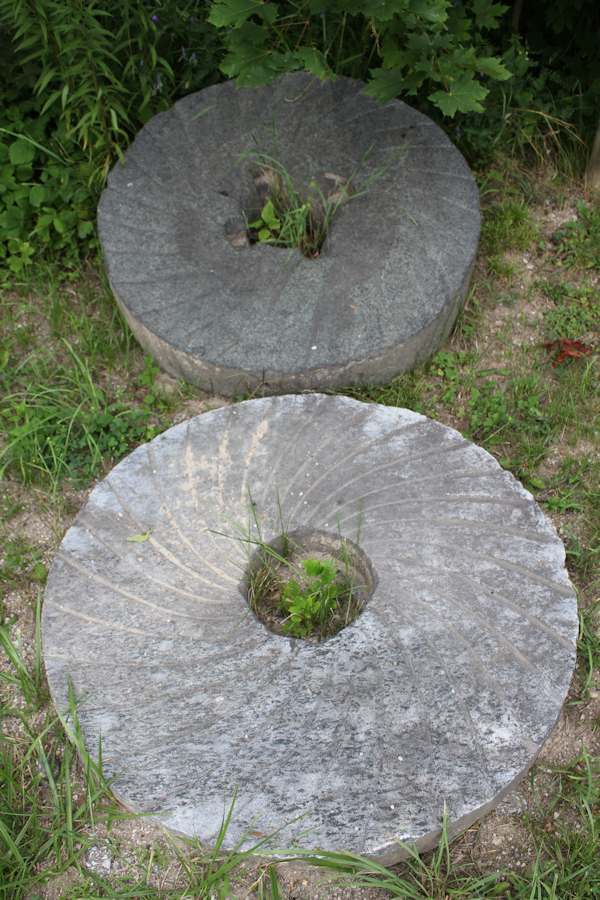
Figure 7D: The two mill stones used to grind flour in Wood's grist mill. (c. 2023)
John Wood, Colpoy's Bay's original founder and my great-great-great grandfather, died on August 8, 1890 at the age of 75 - not long after his mill had burned. No trace of the mill building remains today along the west bank of Colpoy's Creek, but Kribs Road bridge still marks the location of Wood's old mill road. Despite recent reinforcement work, the bridge was permanently closed to vehicular traffic in December 2003. This was due to concerns that the structure, which I believe originally dates from the early 1920s, could no longer saftely support the weight of traffic. Two stone benches now sit on the bridge, commemmorating the history of Colpoy's Bay.