- Recent Updates
- Colpoy's Bay
- Colpoy's Bay Introduction
- Spragge's Hill
- The Kalbfleisch House
- The Kalbfleisch Dock
- The Kalbfleisch Marina
- Whicher's Sawmill
- The Wrecks Near Whicher's Mill
- Frame's Falls and John Wood's Grist Mill
- Albemarle Street
- Hughenden and Whicher's Store
- The Community Hall
- The Forest Home Hotel
- The Colpoy's Bay Schoolhouse
- The Colpoy's Bay Church
- Edgehill Cemetery
- Colpoy's Bay From the Air
- A Glimpse of the Past
- Wiarton
- Berford Street
- Berford St. Part 2
- Berford St. Part 3
- Wiarton Harbour
- Bluewater Beach
- Caframo Ltd. and Wiarton Cement Works
- Wiarton Beet Sugar Factory
- Wiarton's Hotels
- Wiarton's Schools
- Wiarton's Banks
- Grand Trunk Railway Station
- The Wiarton Fish House
- The Wiarton Fish Hatchery
- Wiarton's Berford Theatre
- The Wiarton Woolen Mills
- Wiarton's Furniture Industry
- Wiarton's Hospital
- Wiarton's War Memorial
- Wiarton's Town Hall
- Wiarton's Newspapers
- Wiarton's Grist & Flour Mills
- Wiarton's Sawmill Industry
- Wiarton's Gateway
- Connecting Passages
(Links) - Present-day Map
of Colpoy's Bay - Colpoy's Bay
Lot Map (1870) 
Wiarton Timeline- Present-day Map
of Wiarton - Bibliography
- About the Author
- Site Map
(use if menu doesn't work) - Tell me your impressions!
Bluewater Beach
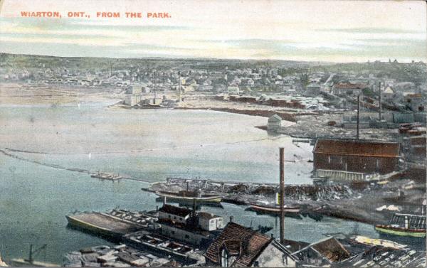
Figure W5A: Wiarton harbour about 1910.
Figure W5A displays a terrific southwesterly view of Wiarton around 1910. This is the bustling lumber town at its peak! The base of Colpoy's Bay is lined with the town's many sawmills and the harbour is filled with commercial and industrial boats, ships and barges of all sizes.
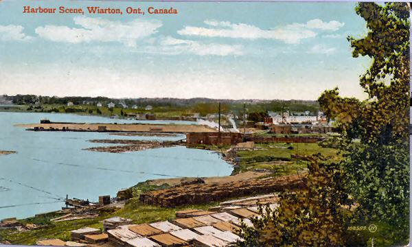
Figure W5B: Wiarton shoreline around 1910.
Figure W5B was taken from a position near centre-right of the previous figure and dates from roughly the same time. Note the obvious piles of lumber at the base of the postcard. A mill is evident at centre, beyond which were two long reakwaters used to shelter lumber floating in the bay.
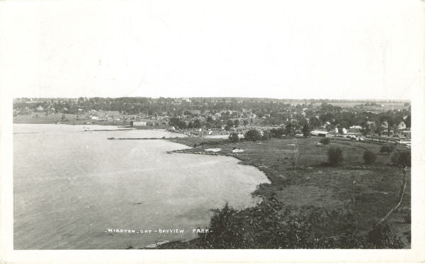
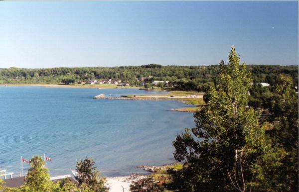
Figure W5C: Wiarton shoreline 1936 and 2001.
Figure W5C shows an almost identical view about 26 years later at top and 91 years later at bottom. The lumber industry on the shore has disappeared and has been replaced by parkland. Only a triangular projection of land indicates where the mill visible in previous images once stood. In the top image of Figure W5C, one can see partial remains of the two mill breakwaters that were evident in Figure W5B. The northern-most of these was expanded in the 1950s to sheild Wiarton's present-day boat launch (more on this below).
In 1921 the Wiarton Women's Institute took the initiative to construct some bath houses to service Wiarton's shoreline. In 1928 the shore was officially named Blue Water Park. The following year the Women's Institute added a collection of one-room cabins, just visible in the top image of Figure 5WC (parallel to the shore).
The cabin marked the arrival of Wiarton's future....tourism. The days of the sawmill were numbered.
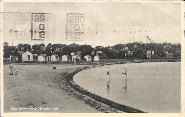
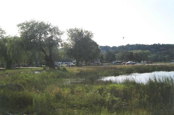
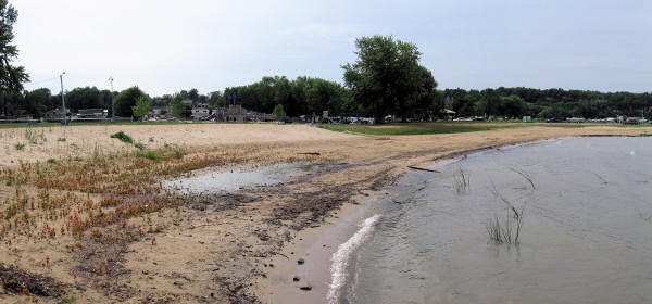
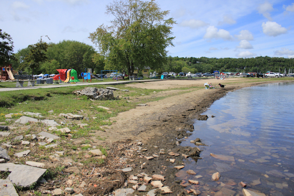
Figure W5D: Blue Water Beach, 1940, 2004, 2006, 2023.
The cabins, as shown in the top image of Figure W5D, lined the shore of Wiarton's park until 1953. That year, an unusually high water level flooded the cabins. When added to the age and primitive accomodations of the cabins, this fact led to the decision to sell the cabins and use the money to construct new ones at a later date (that never came). These buildings would be uncomfortable by today's standards, with only enough room for a bed and perhaps a stove!
In the summer of 1954, a new breakwater was built along the shore to shield a new boatlaunch (still in use today). All the soil dredged from the bottom of the bay was used to "reclaim" a 50 by 200 foot section of beach in front of where the cabins used to stand. By the early 2000s, the shoreline was hedged with boulders in an effort to prevent erosion and/or flooding (see middle image of Figure W5D). As time went on, however, the townspeople began once again to seek the convenience and usefulness of a sandy beach. Thus, in the summer of 2006, the boulders were removed and several truckloads of sand were laid down just south of where the W.I. cabins once stood. Unfortunately, the topsoil was not properly treated before the sand was dumped on the ground, thus, within weeks, the "new beach" was already dotted with weeds (see third image of Figure W5D). As of 2023, a narrow strip of sandy beach remained established, as seen in the bottom image of Figure W5D. The background of that picture also highlights the boardwalk and playground equipment that had been put in place.